
Civil Air Patrol’s National Radar Analysis Team helped locate two missing aircraft in separate missions in August 2026, contributing data that guided responders to crash sites in Colorado and West Virginia. All five people aboard the two aircraft survived.
The Air Force Rescue Coordination Center requested the team’s assistance after an Army Black Hawk went down near Denver and a homebuilt aircraft was reported missing in West Virginia. In both cases, the team analyzed raw radar returns and Automatic Dependent Surveillance–Broadcast data to narrow the likely locations.
Radar work narrowed the search
The West Virginia aircraft had been reported missing after a local flight from Jackson County Airport. The alert contained an incorrect departure time, and the aircraft was not transmitting ADS-B data. CAP volunteers reviewed raw radar records, identified a track matching the aircraft’s profile and passed a location map to the rescue coordination center and local authorities.
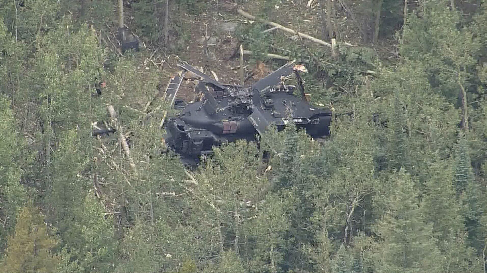
In Colorado, the Black Hawk was also not transmitting ADS-B data. CAP’s team used raw radar and low-altitude tracking tools to identify a likely crash area near Thorodin Mountain. The team provided an initial map within 10 minutes of the rescue center’s call. Responders found the helicopter and rescued all four soldiers aboard.
A volunteer capability behind the scenes
CAP says its National Radar Analysis Team has participated in nearly 1,100 missing-aircraft missions since it was formed in 2009. The volunteer team combines radar, ADS-B, weather and other data to provide search teams with actionable locations. Its role is analytical: it helps direct responders toward an area where aircraft and ground teams can continue the search.
The missions show how aviation search and rescue can depend on more than aircraft overhead. Fast data review can reduce the area that responders need to cover, especially when a missing aircraft has stopped transmitting a track. In both August cases, the location analysis helped rescue teams reach survivors.
Source
Based on Civil Air Patrol News’ report on the two missions. Photo: Civil Air Patrol, from the same report.


No comment